
Someone close to my heart taught me that it is never too late to do the things you love, to take chance on everything. That it is okay to cry on the things you can’t understand and to laugh your heart out because you are simply happy. Life is indeed too short, and he lost his battle to it. He may have left me with a broken heart, but he showed me how to live.
The ray of the golden sun awakes me. It has been 3hrs since we left Dangwa Terminal and we are still on the road. The ordinary bus was filled with passengers, there’s not enough seat for everyone and all is willing to stand on their feet and endure the long travel just to be home before the holiday.
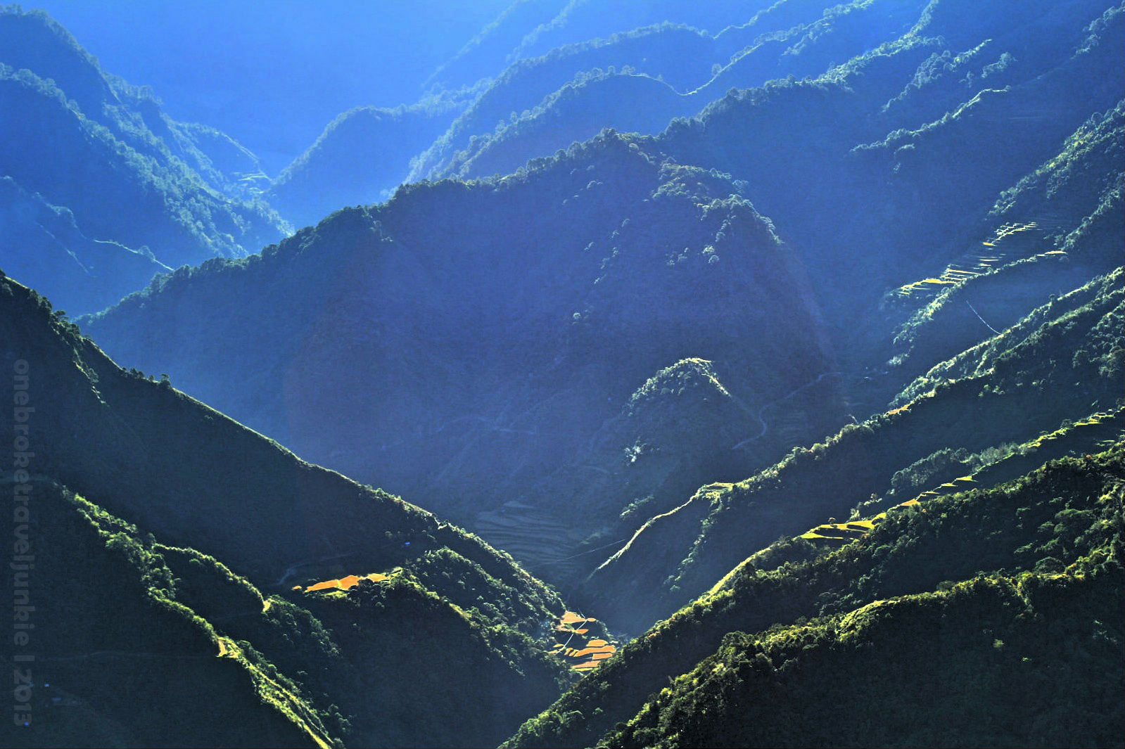
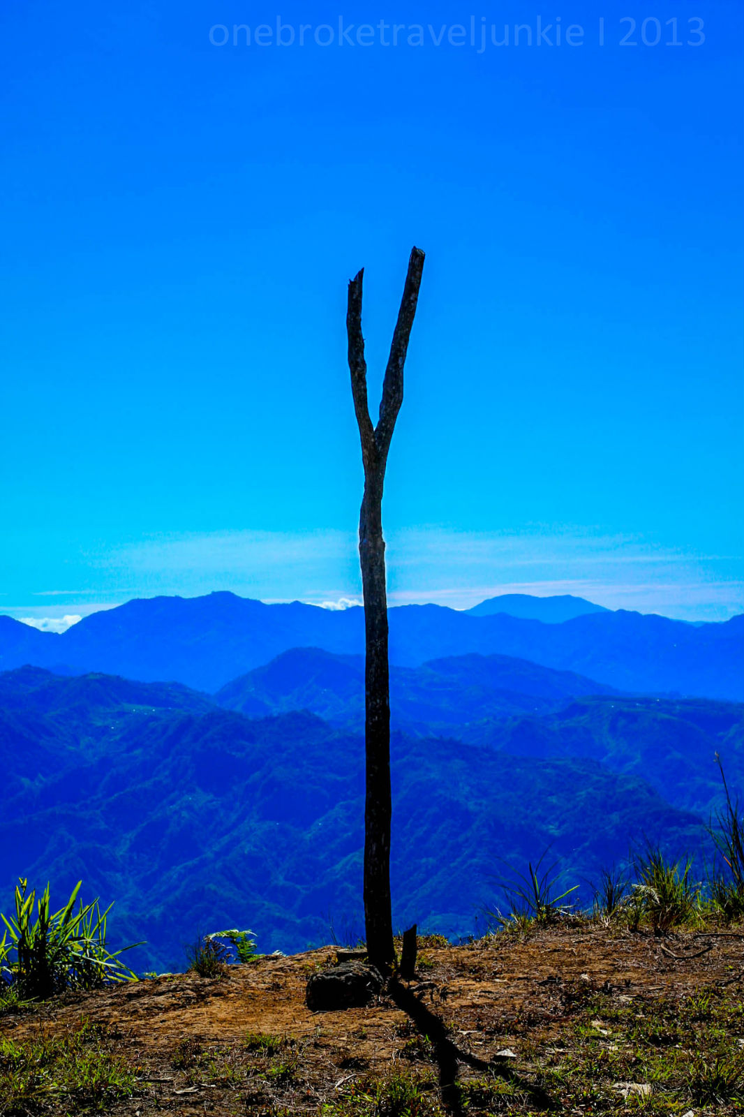
We have so much love for the Cordilleras that we decided to hike again on its mountain 4 days after conquering Mt. Pulag. The blue sky is a promise of a good weather while the breathtaking scenery outside the bus window assured us of an epic year end climb.
After a couple of stop overs, we reached Poblacion. We’ve met kuya Mark, the guide arranged to us by Sir Charo, our contact in Kibungan. We were not able to meet him but Ms. Wenday from the Municipal government gave us a warm welcome and made sure we have everything we need before our climb.
Josh and I travelled 62 kilometers north of Baguio City to get to the town with a unique mountain. Endured an almost 11hr bus ride from Cubao to Baguio City to Kibungan Benguet to experience the Great Kibungan Circuit, this will be our longest hike to date.

The Circuit is comprised of Mt. Tagpaya, Mt. Oten and Mt. Tagpew. For three days we will live inside the pine forest, for three days we will walk to a place we can call home.


We had our lunch in the sleepy town and bought some supplies. At exactly 1:30pm we started our hike. On the first part of the trail you will walk on a wide rough road passing some local houses and a school. It was a continuous descent all the way to Tanap River. Akala nga namin ee pauwi na kami at puro pababa, hangsakit sa paa!

After crossing the Hanging Bridge you will then face an assault up to Abas Community under the scorching heat of the sun. Puro paakyat naman ngayon. .nyaaahhh!


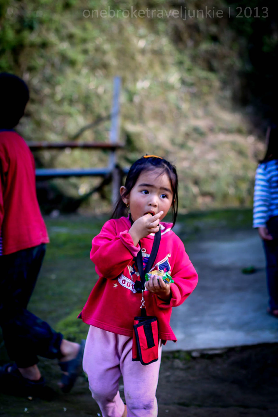
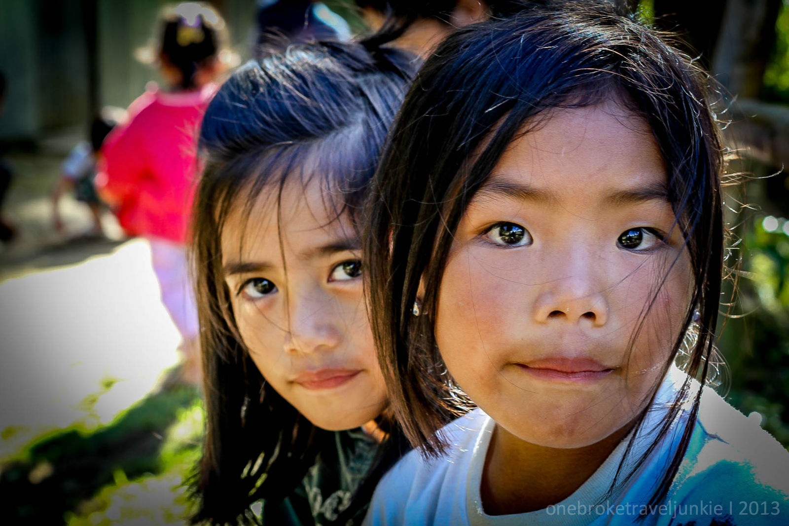
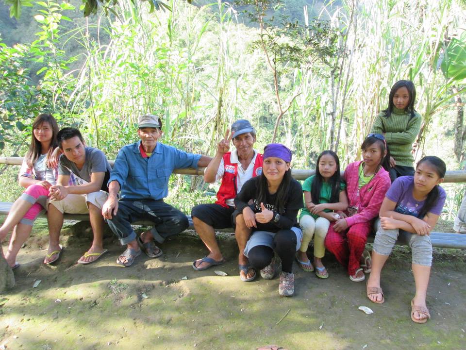
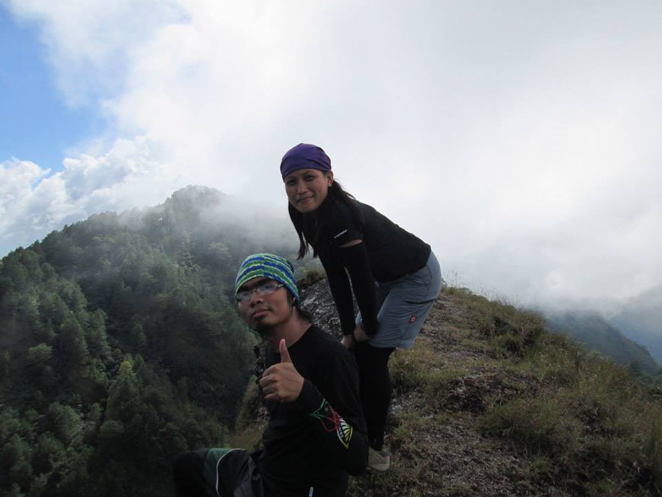
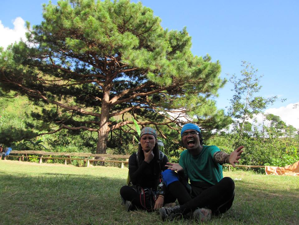
It was 2:30 pm when we reached the Community. The Kankanaey Tribe is having a Kanyaw, an Igorot Ritual, we are lucky enough to witness it. Some were dancing to an ethnic music outlandish to my ear while the others are preparing for the feast. They asked us to stay for a while.
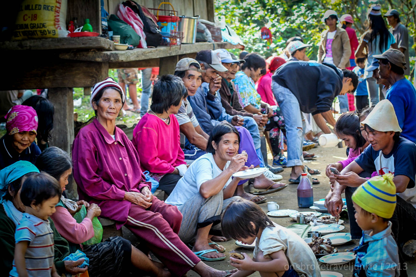
I took the time to capture these priceless moments with the kids in the village. They are the cutest.


The Kankanaey people are very hospitable; they’ve offered us food and made sure we have enough water to bring on our hike. We had a little chat with them and I was surprised that they are conversing in English and not in tagalog, especially the elders.

I asked kuya Mark about this, he said aside from their local dialect; English will be the second language in the village because of the influence made by the missionaries over the past years. Those who can speak tagalog are the ones who had been in the lowlands, especially to the city.

An hour after, we courteously said our goodbyes to them and promised the next time we get back we were able to speak at least a little kankanaey words to chat with them.
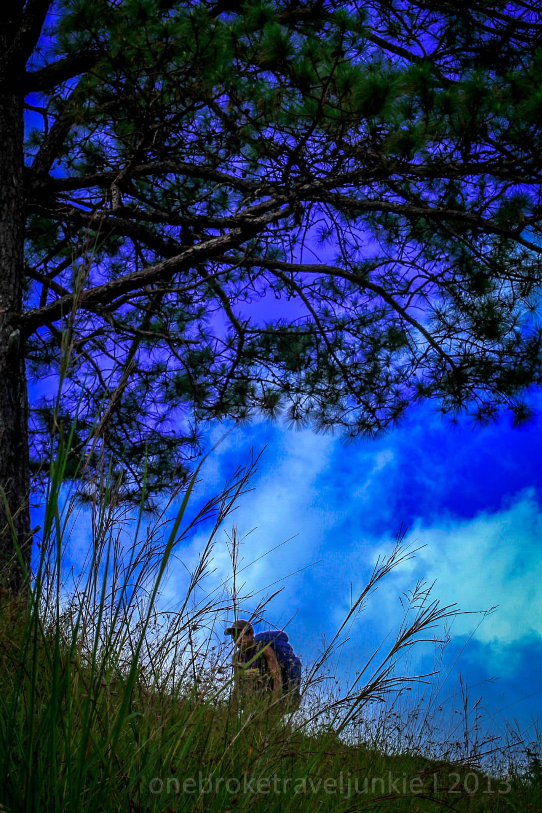
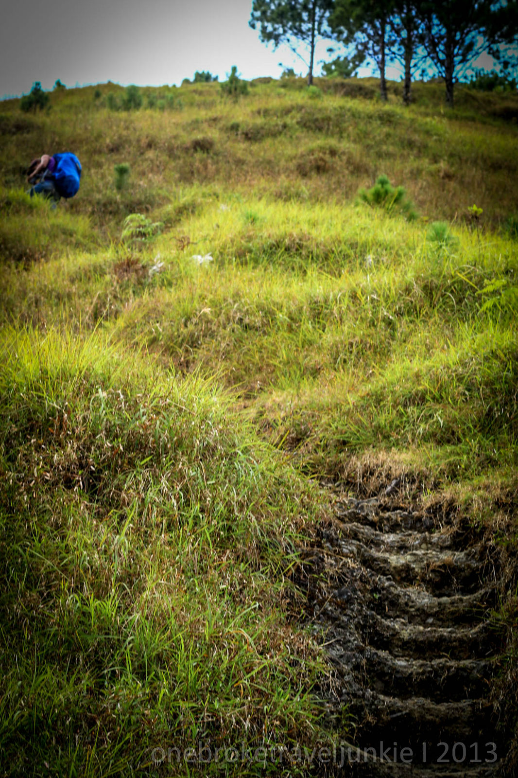
We entered the pine forest as we continue with our trek. The heat of the sun turned into a cold freezing environment as we walk on a steep terrain. From time to time we would stop to catch our breaths.


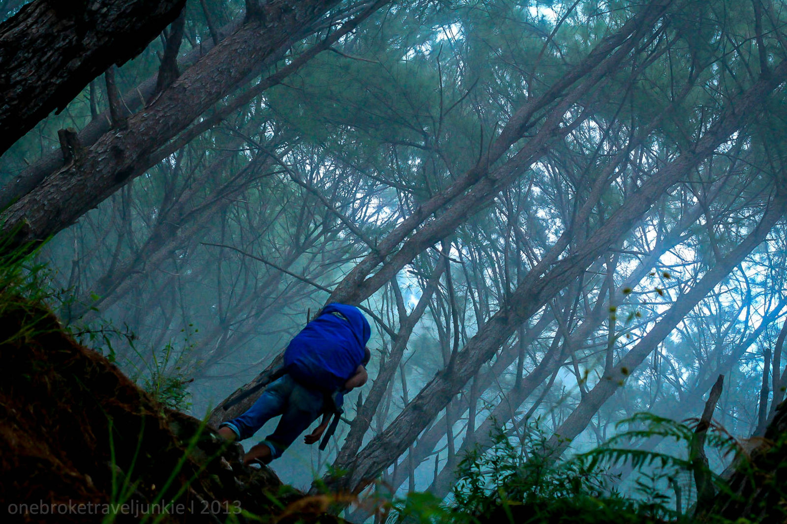

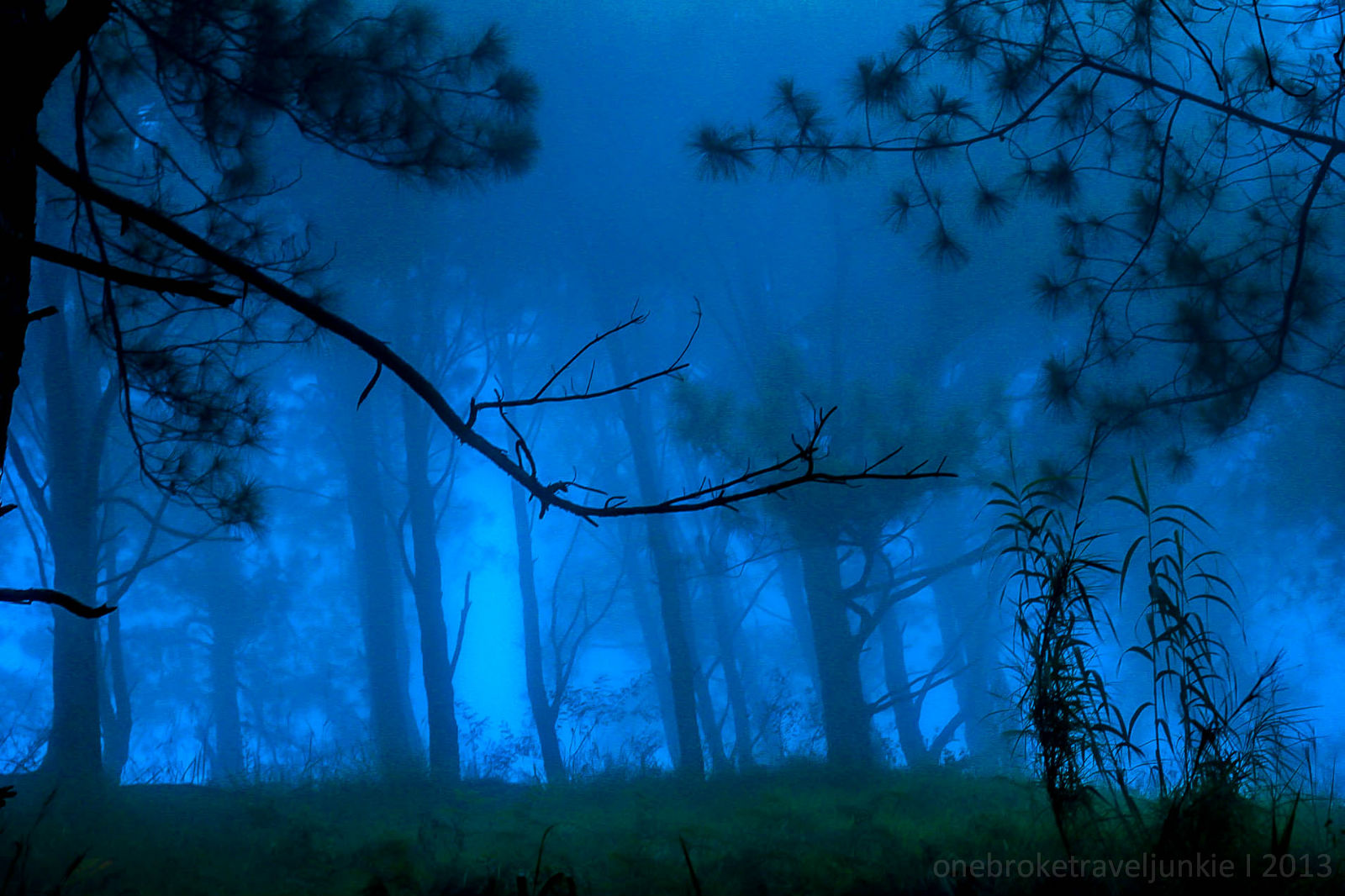
The fog enfolds us, creating an enigmatic feeling, as if a werewolf is watching behind the mist. I just hope it would be Jacob Black.. or else nyahahahah! 😀

Kuya Mark and I walked slowly; we’re not even talking to save energy. I checked on the time, quarter to 5. It’s already getting dark. I stopped for a quick rest and asked how far the campsite is. ‘Malapit na po mam, dun po sa taas na yun’, he pointed. I can see it but it seems we still have a long way to go.

Josh is way behind us. After about 15 minutes he still out of sight. I worriedly shout for his name.. parang ganito ‘jjjoooooosssshhhhhhhh’.. mga 5 minutes naming ginawa to ni kuya Mark. Then we heard a response, we saw him. ‘Sorry nakatulog ako.. at nanaginip pa. Nasa bahay na daw ako at gumagawa ng collage ng kibungan tapos pag dilat ng mata ko nasa trail pa pala ako’ we both laugh 🙂

Without further delay we began to walk again. It was another assault to the campsite of Mt. Buga. Josh was not feeling well since we started our trek. The colds and headache slowed him. He asked us to go ahead, although a bit hesitant because of his condition, I proceed thinking if I can reach the campsite before the night falls I can setup our tent and we can rest at once.
It was 5:30 when we reached a clearing. We made it to the e-camp of Mt. Buga. There’s a water source just below the site. While pitching our tent, kuya Mark fetch water for us and told me he will spend the night on the nearby house.
I immediately prepare for dinner, Kare-kare for a reward. From where I am, I can see the distant community lights and the ocean of stars above the night sky. Josh has a slight fever, I asked him to rest while our food is being cooked.
The mountains silhouette plus the darkness around me gives an eerie feeling. It’s as if there were eyes watching.. ee ganun talaga kasi yung imagination ko. Nyahahaha 🙂 ! To keep myself busy, I texted Rodel, their group is currently at Lake Tabeyo to camp and will hike Mt. Tabayoc in the morning, their 2nd mountain to complete the Luzon 3-2-1.. mga hardcore ee :). So with a phone on the left hand and a knife on the right, that’s how paranoid I was 😀 nyahahahah! Kaya naman kahit hindi pa luto ang kanin ay pinilit ko ng gisingin si Josh para makakain na at makatulog.
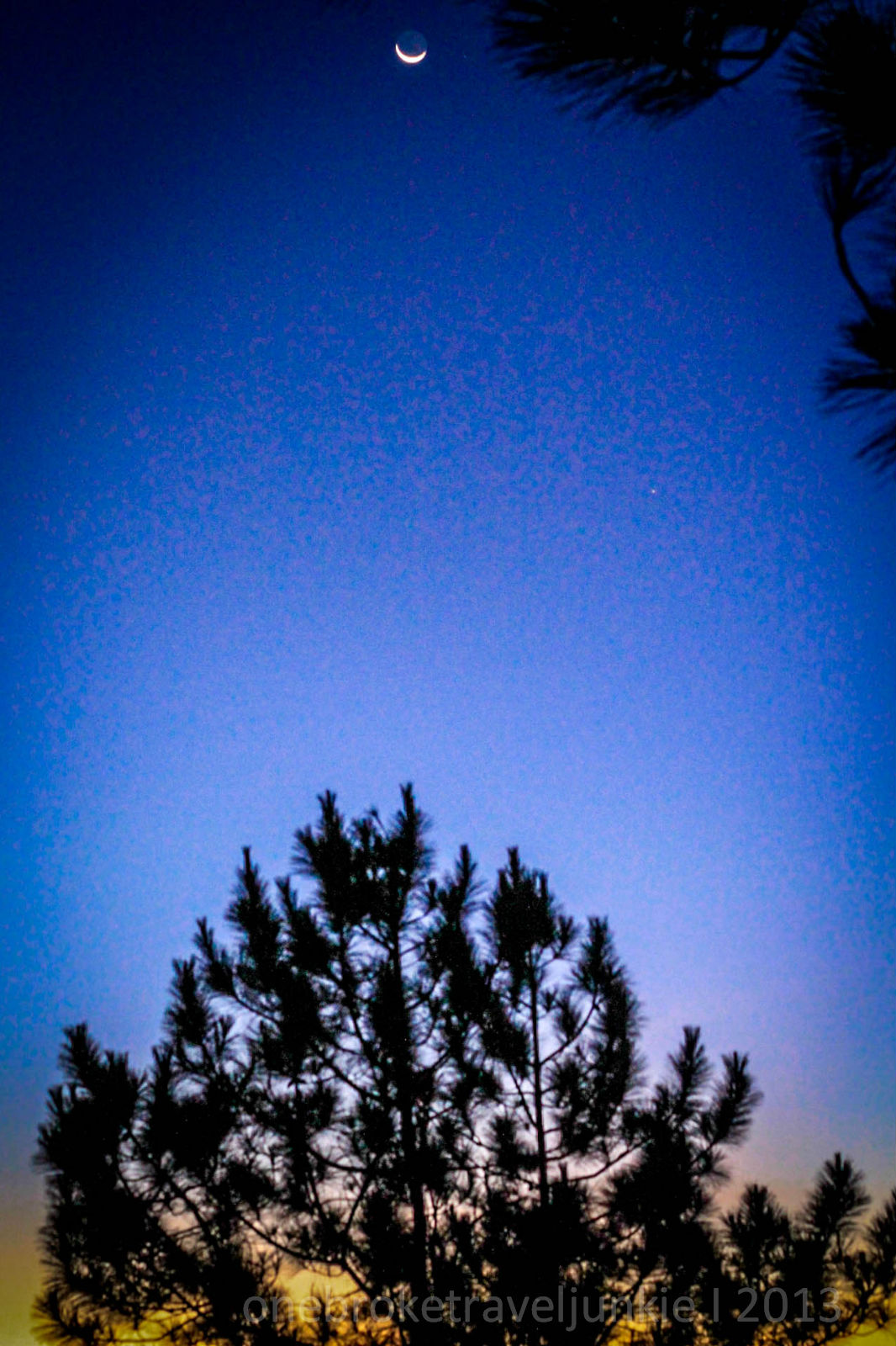
It was an incomparable day 1. We had a good hike. I closed my eyes with so much happiness in my heart, for that night we slept with the stars shining brightly above us.
Day 02: Mt. Tagpaya (1820 masl) to Mt. Oten (1875 masl)
We woke up at 6am with a surprise. Mornings should always be like this.

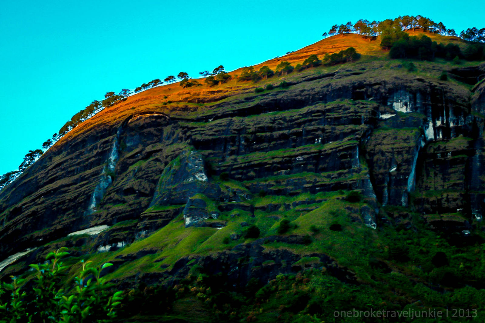
The glorious sunrise slowly awakens the Big Rock in front of us. Its top has pine trees perfectly planted. I thank God for things like this.

At dahil food fest kami.. nakapagluto pa kami ng breakfast. Mac in chilli beans at Creamy Mushroom Soup nyahahahah!We proceed with our hike by 9am. The sun is already up, reminding us of a tough day ahead.
The weather in Kibungan can be compared of those in Mt. Lobo. The heat of the sun can drain your energy and sometimes your sanity. Kaya naman kung maka take five kami ee wagas.. walang halong pag mamadali.. hahaha.
We’ve met a group of mountaineers on their way down. They did an outreach on one of the communities in Kibungan. Saludo kami mga sir at mam!
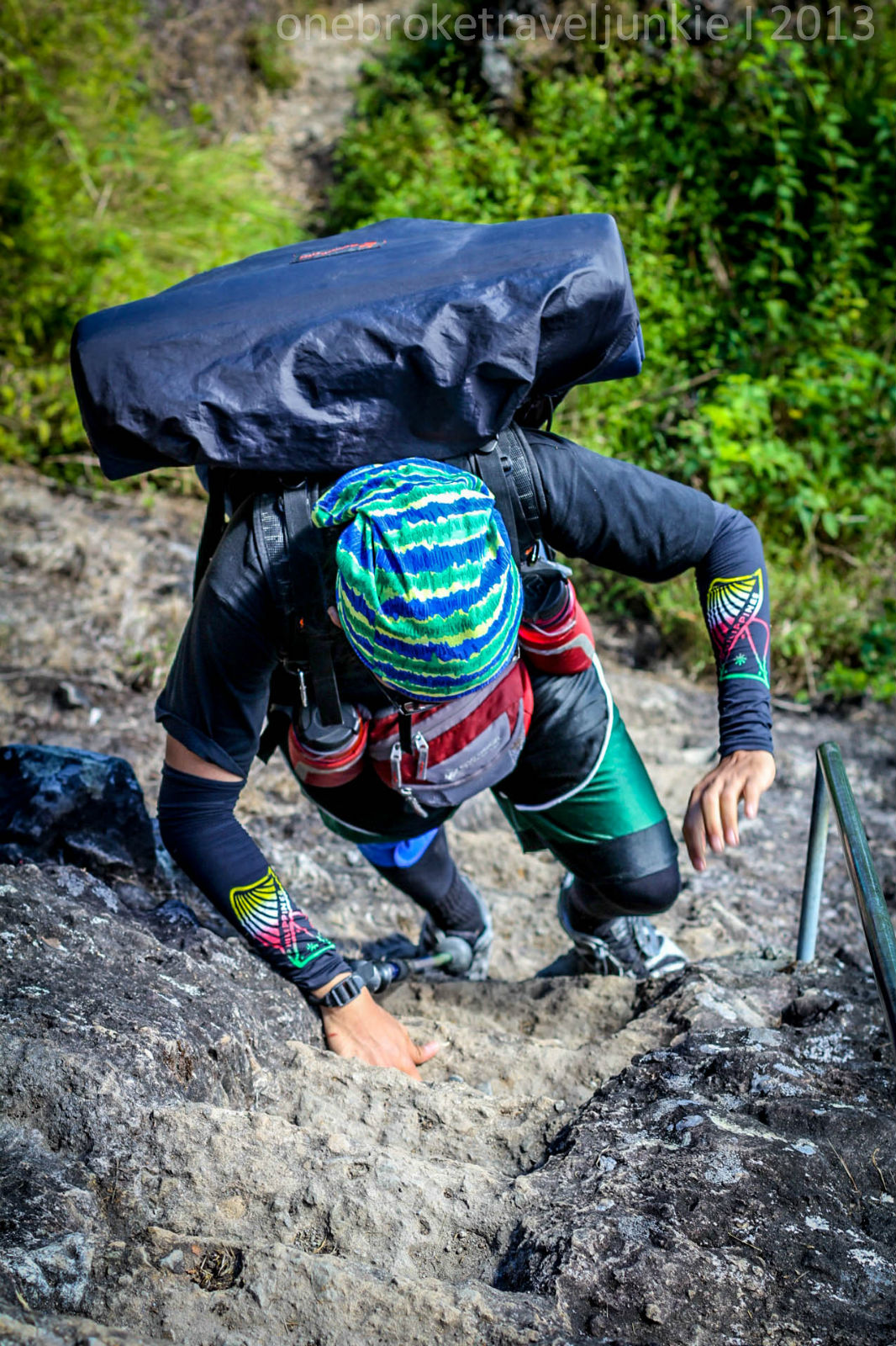
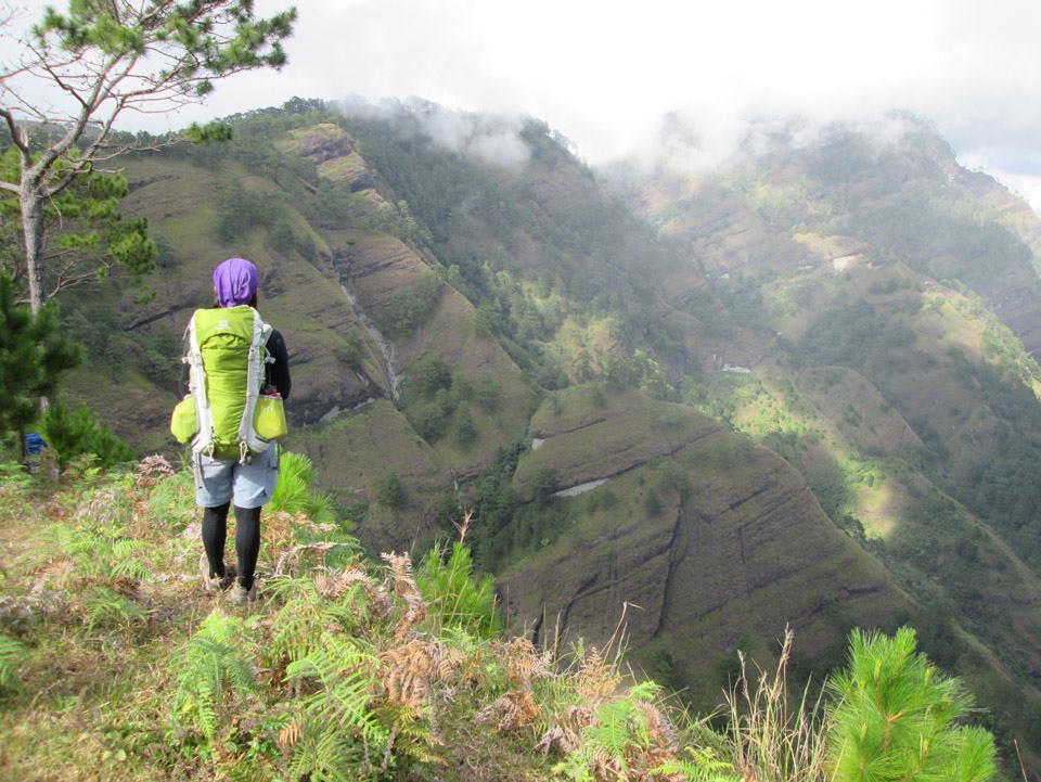
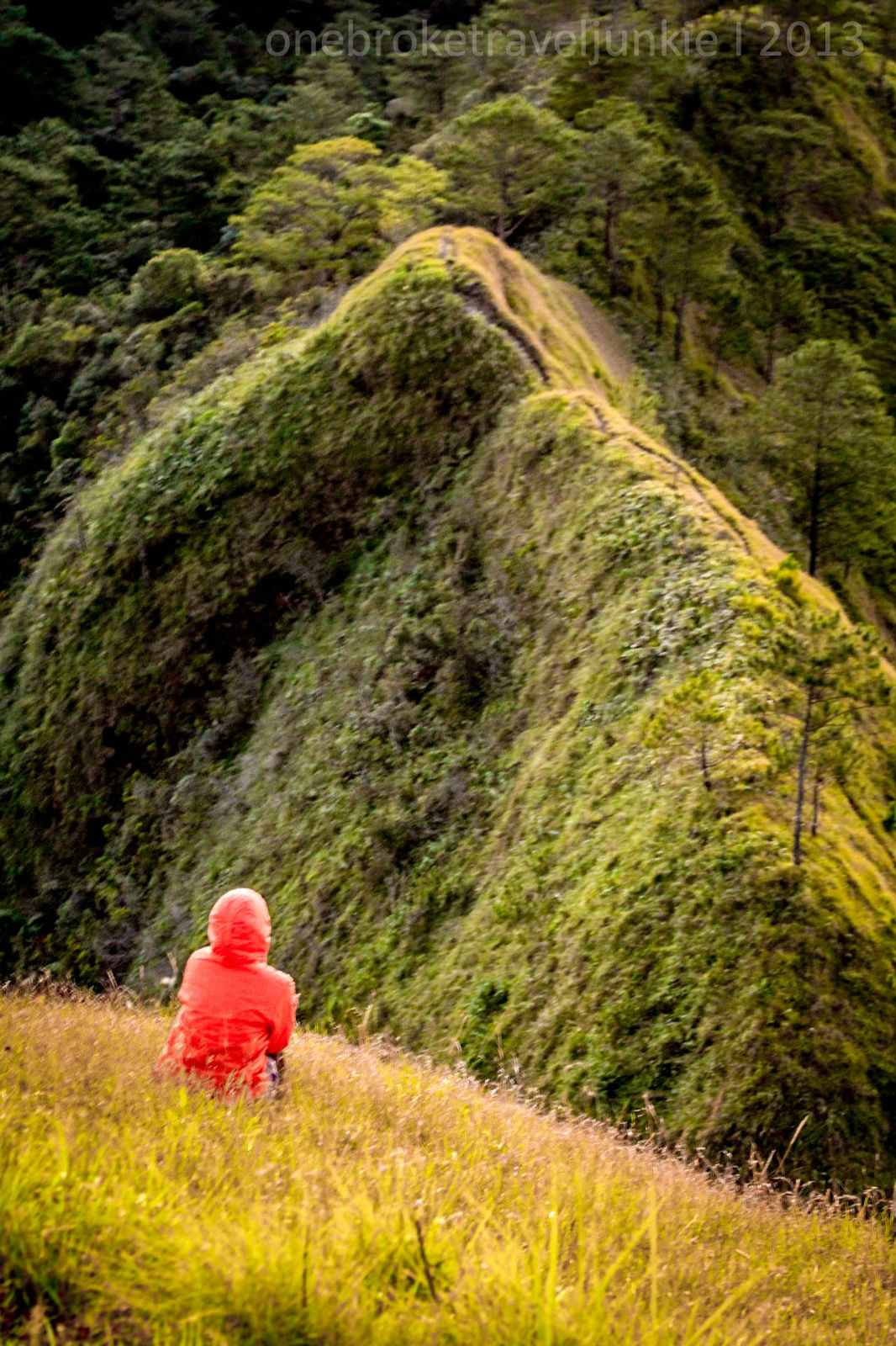
Our patience was put to test on the steep trail of Mt. Tagpaya. It was an endless ascent. On some part you would have to climb into the steps carved on the mountains boulder.
By 11:15 we’ve reached the campsite. We had sisig and rice under the pine trees with a superb view of the rest of the Cordilleras. It was perfect.


We spent an hour lying on the earth’s floor, staring at the cloudless blue sky. My heart always wander in a place like this.. a place where Life struggles do not exist.


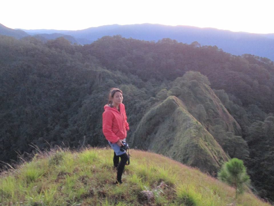
10 minutes from where we are is the summit of Mt. Tagpaya.

It was 12:30 when we decided to descend and continue with our trek to Mt. Oten. It was a never ending trail of ups and downs. We walked without complaining, for every step towards the next summit offers a rewarding scene.


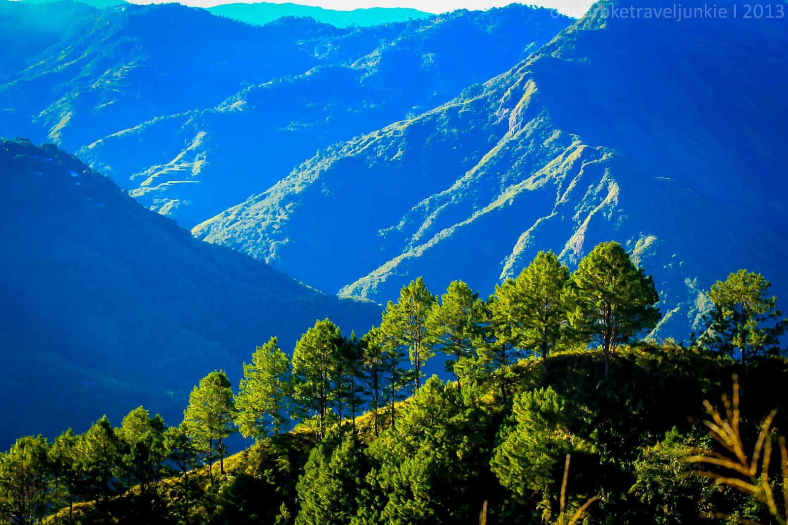
After about 2 hours the trail transitioned into a mossy forest. The verdant moss gave a refreshing feeling. Pitcher plants are also abundant on this area. It continued until the next water source marked by a hanging bridge.


The original plan was to hike all the way to Mt. Tagpew (2105 masl). Kuya Mark told us we could reach the campsite by 8pm. This made me hesitant. It’s not a problem to do a night trek however since we were both exhausted chances are we might get there later than 8pm.. isa pa sayang ang view ng Kibungan.

So we both agreed to spend the night at Mt. Oten’s campsite, the only consequence is that there’s no water source nearby.
By 430pm we finally made it to the campsite. We immediately set up our tent and prepare for dinner. A creamy Macaroni Soup Kibungan style is perfect for the freezing weather.

It’s our second night inside the Great Kibungan, and it was exactly a year when Josh and I became hiking buddies. It was through a decision-from-the heart that we had our first hike at Mt. Romelo, and after that we would always hike together. Decisions came from the heart will always lead to wonderful things, just like meeting another adventurous soul whom you share the same passion, just like having sensible conversations whenever you feel like talking about random things, just like these priceless moments at the campsite. It was just us, the starry sky and the pale moonlight.


DAY 03: Mt. Tagpew (2105 masl) and the Traverse
We woke up to a cold Monday morning. It was 6am when we saw our first light, a magical tangerine sunrise.
The Cordillera Mountains will always have my heart.


We still have one more mountain to conquer, so after a quick breakfast of what we could cook, we fixed our things and start the descent at 7:30.
We learned from Kuya Mark that Kibungan can be traversed to Ilocos Sur exiting La Union. He said this can be done in 4 days..nyaaahhhh! I got excited again.Kibungan never fails to surprise me. That’s another reason to come back.

a distant view of Ilocos Sur
Again the trail going to the 3rd mountain is a combination of ups and downs. Pa ahon kung pa ahon at pa baba kung pa baba. After a walk through the pine trees, once again we found ourselves inside a mossy forest. Nakaka amaze talaga. You will pass by another water source before you proceed to the summit.

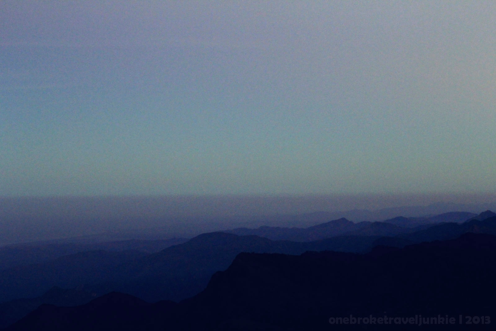
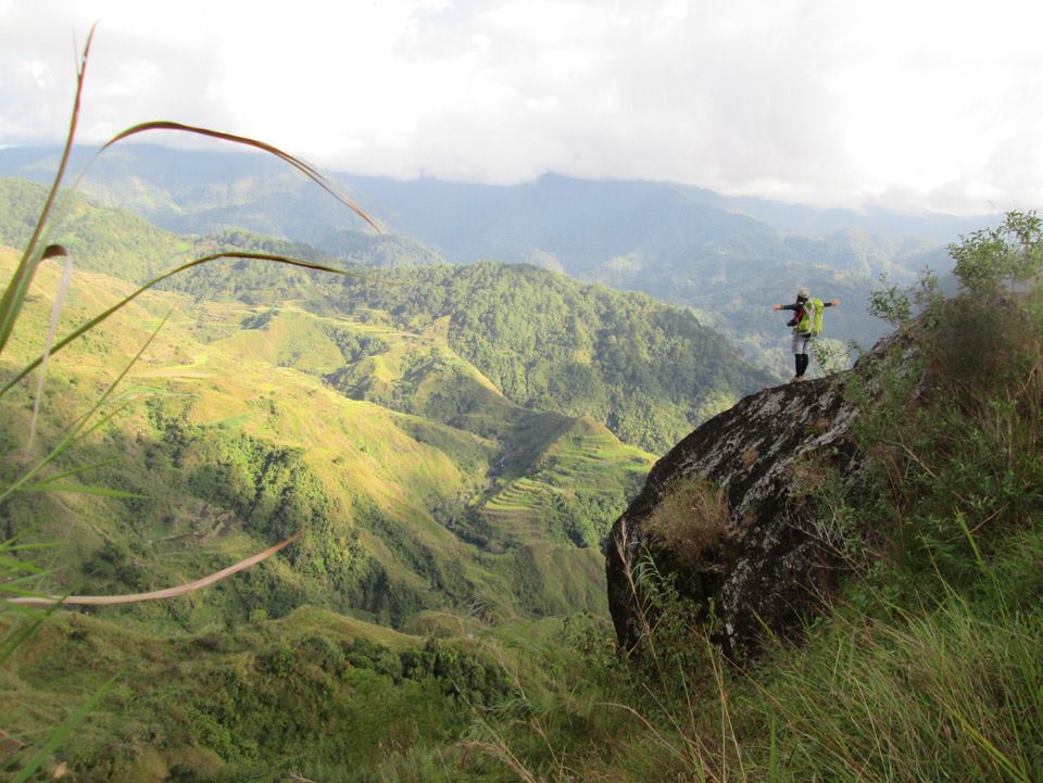
After 4hrs we’ve reach Mt. Tagpew. The summit has a landmark to set the boundaries for the 3 Municipalities of Benguet; Kibungan, Atok and Bakun. We have also seen a distant view of Mt Sto Tomas and Mt. Ugo and the Bakun Mountains.

a distant view of Mt. Sto. Tomas as view from Mt. Tagpew

a distant view of Mt. Ugo

Bakun Mountains
The sun is shining brightly against the cold morning breeze. We shivered while preparing for whatever we can cook for lunch. Kasi nga fiesta kami nung day 1 at day 2 kaya naman ang natira samin ay isang latang Beef loaf at knorr cubes na ginawa naming sabaw..nyahahahahahha! ang alat! 😀


The rest of our idle time was spent gazing at the clear blue sky again, imagining things formed by the fluffy clouds. Puro dinosaur yung nakita ko pero si Josh ay may kakaibang nakita nyahahahah! 🙂
Wew! This is life. If only I could freeze the moment but we still have to hike 8 hours to complete the Circuit.
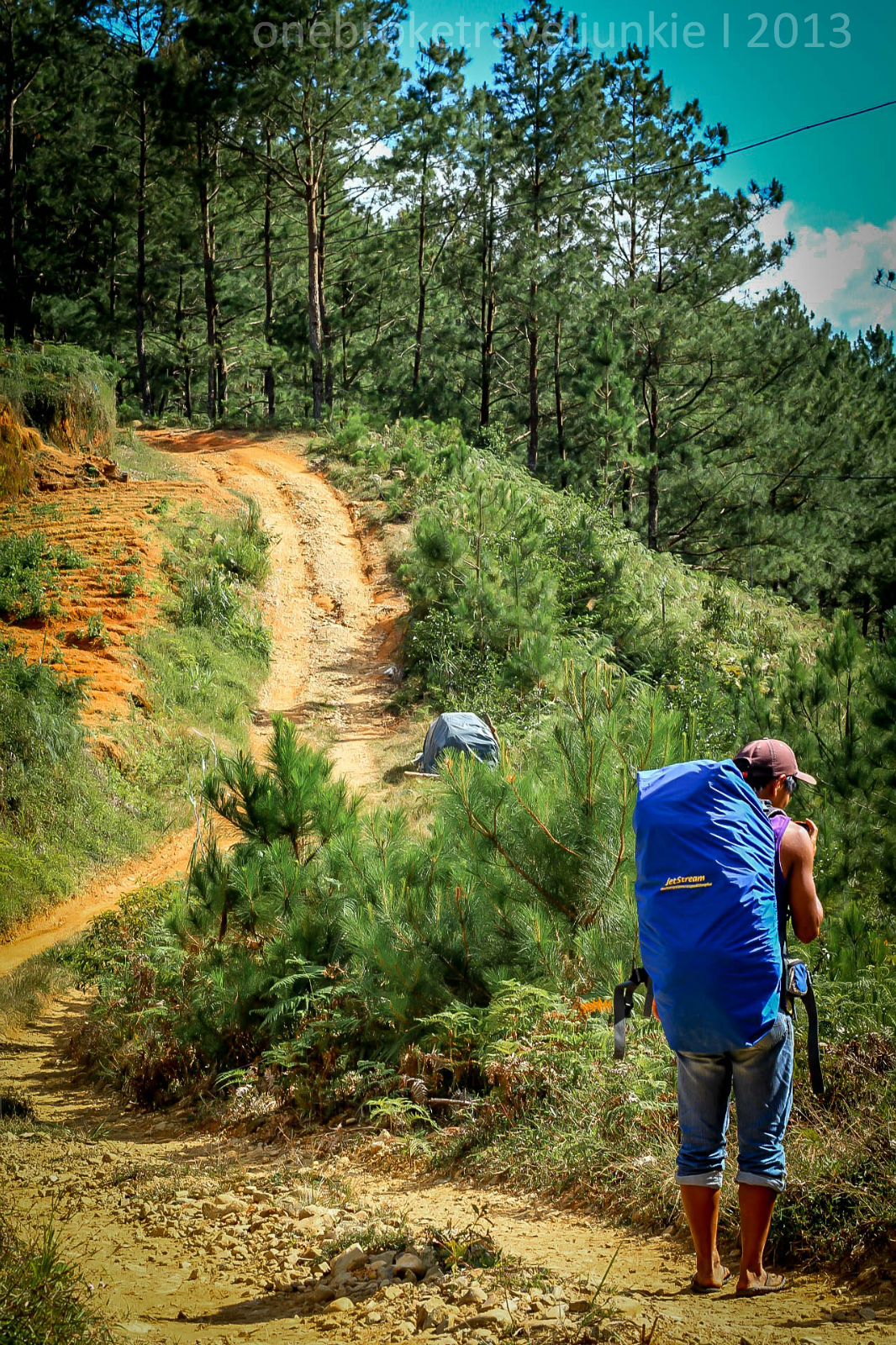
The walk back to Kibungan started at 130pm. Kung ano yung haba ng inakyat naming pataas, ganun din kahaba yung binaba namin. At some point we did try to trail run, but the loose soil prevents us from continuing.
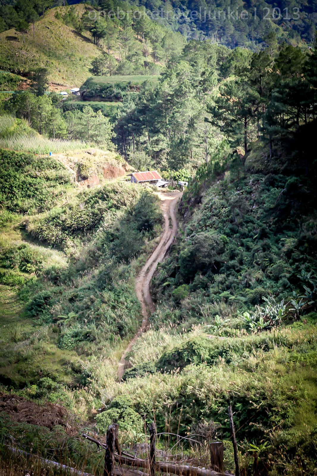
As we approach Beyeng Community we noticed a lot of trash along the trail. Nakakalungkot. It came from the villagers who pass on this part of the trail according to kuya Mark. I just hope the Kibungan government can disseminate environmental education to the Community; after all they are collecting fees from Mountaineers. We picked whatever trash we can see, kaya lang sa dami ee hindi namin kaya ibaba lahat.

At 2:30pm we reached a wide rough road. We walked under the unforgiving sun.

By 3:30pm we made it to the next water source, it was at St. John’s Chapel.

Take 20 minutes muna tapos picture picture.
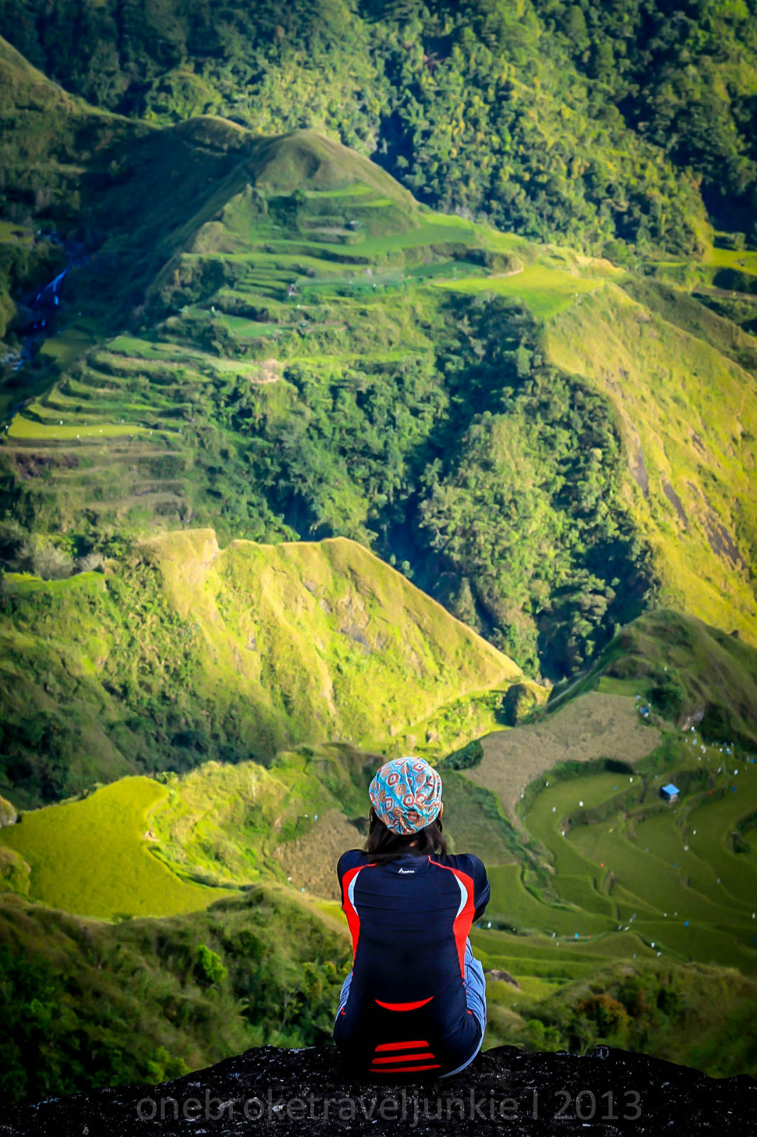
After an hour of continuous walking out of the wide rough road, we found the Bato Viewpoint. It gave us a magnificent view of Kibungan’s Rice Terraces.

We were at Mayos River at 5:15. It was starting to get dark. Yes! 4 hours nalang!


We trek the night crossing the rice fields. Our headlight was a life saver when darkness surrounded us.
At 7:15 we finally made it to the Hanging Bridge of Tanap River. From here it was an endless assault until you reached Poblacion.Nagkatakutan pa kami nung malaman naming may nadaan kaming sementeryo, napabilis tuloy yung pacing naming nyahahahah! Pa relax-relax pa kasi 😀
I enjoyed the night, for without the dark we will never see the stars. We’ve made it back to civilization by 9:15pm.
We have completed the Kibungan Circuit. We walked 23.5 kilometers. For 3 days we experienced the great outdoors. We slept under the star lights and witnessed a fascinating sunrise. We watched the fluffy clouds being blown by the cold cordillera wind. We wander and received more than we seek. It was an Epic Year End Climb.

When my heart wanders in the Great Kibungan, it made me realize a lot of things. That there is an end to all your ups and downs.. just like the trail. That Happiness is always a matter of choice whatever your situation is. Just like walking endlessly on the trail and knowing that at the end of it something wonderful is waiting. The year changed a lot of my perspective in life, the way I see things, the way I value them and whatever the next will bring me I will always be reminded to take a chance because we never know what might happen, to cry when you feel like crying, to laugh your heart out because you are simply happy. To live and not just to exist, to keep the faith and to believe on second chances.

Thanks buddy for a year full of amazing adventures.
ITINERARY:
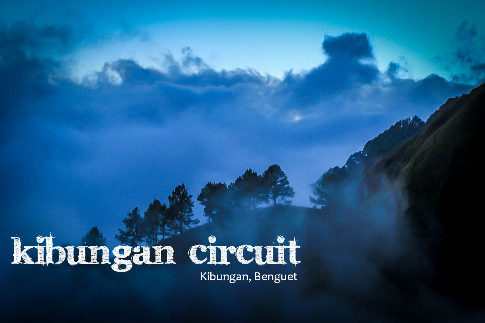
KIBUNGAN CIRCUIT
Kibungan, Benguet
Jumpoff (closed loop): Sitio Tanap, Poblacion, Kibungan
LLA: 1820 MASL (Tagpaya); 1875 MASL (Oten); 2105 (Tagpew)
Days required / Hours to summit: 2-3 days / 6-9 hours (Tagpaya)
Specs (Version 1): Major climb, Difficulty 5/9, Trail class 1-4
Specs (Version 2): Major climb, Difficulty 6/9, Trail class 1-4
Features: Pine ridges, mossy forests, rice terraces, village walks
Day 01:
10:00 – Cubao to Baguio
04:00 – ETA Baguio
Day 01:
04:00 – Taxi to Dangwa Terminal *Breakfast*
06:00 – Baguio to Kibungan
11:00 – ETA Poblacion, Kibungan
12:00 – Luch at Kibungan and buy supplies
01:30 – Start Trek
02:30 – ETA Abas Community
03:30 – Start Trek to E-Camp
05:30 – ETA E-Camp Mt. Buga
Pitch Tent – Dinner – Socials – Lights Off
Day 02: Mt. Tagpaya to Mt. Oten
07:30 – wake up – breakfast – break camp
09:00 – Start trek to Mt. Tagpaya
11:00 – ETA at Campsite *summit is 10 minutes away* *Lunch*
12:30 – Start Trek to Mt. Oten
04:30 – ETA Mt. Oten Campsite / summit
Pitch tent – Dinner – Socials – Lights Off
Day 03: Mt Tagpew back to Tanap
06:00 – wake up – sunrise viewing – breakfast – break camp
07:30 – Start Trek
10:30 – ETA Mt. Tagpew Summit *Lunch*
01:30 – Start Descend
02:30 – Beyeng Community
03:30 – St. John Chapel
04:00 – Bato View deck
05:15 – Mayos River
07:15 – Tanap River *Hanging Bridge*
09:15 – ETA Kibungan Poblacion
*End of Trek*
EXPENSES:
P900 – Cubao – Baguio – Cubao
P260 – Baguio – Kibungan – Baguio (P130.00 one way)
P1500 – Guide (shared – 500 per day)
P90.00 – Green Fee (30 / person x 3 days)
**Food Expenses depends on the Groups Menu**
HIKING NOTES:
– First trip of bus from Baguio to Kibungan is 6am. Last trip at 11am
– First trip of bus from Kibungan to Baguio is at 5am. Last trip at 11am
– There are only 10 guides available to do the Kibungan Circuit. It is advisable to make necessary arrangements to the Municipality of Kibungan before your hike to assist you in securing a guide and porters. We highly recommend Kuya Mark 🙂 . No need to secure a permit. The road going to Poblacion is prone to landslides.
– There are small stores in Kibungan which you can buy your supplies, but not all that you need is available there, especially butane.
– Cellphone Signal is available (Globe and Smart) and maybe intermittent on some part of the trail.
– There are at least 8 water sources in Kibungan. If I can remember them correctly;
- Abas Community
- E-Camp Mt. Buga
- Along the trail going to Mt. Tagpaya
- Bulalacao going to Mt. Oten
- Along the trail going to Mt. Tagpew
- St. John Chapel
- Along the trail going to Mayos River
- Along the trail after Mayos River
– There’s a lot of stray dogs during the night in the community, be extra cautious.
– You can sleep at the Municipal Guest House for P200.00 per person. They have a clean restroom.
– Hot spring in Kibungan is a perfect sidetrip 🙂
– Stores in Poblacion are only available until 8pm.
– Be courteous at all times 🙂
***KEEP CLIMBING*** 🙂 🙂 🙂


good day mam pwede po ba maka hingi ng contact person nung guide nyo =) salamat po and god bless
LikeLike
wow!!! im impressed with u guys , welcome to our humble hometown Kibungan , hoping to see u someday
LikeLiked by 1 person
thank you 🙂
LikeLike
Hi… I just saw this post today from my FB friend.. nilagay nya sa timeline nya… kame yung nakasalubong nyo sa daan na nag outreach jejeje. Good to know you were OK kasi we were kinda worried coz it was a bit late when we saw you guys….
LikeLiked by 1 person
amazing!sana po makasama kami sa mga outreach programs nyo. feel free to invite us 🙂 saludo po kami sainyo
LikeLike
,hallow po,, outreach uli namin this comming june 21-22,, your welcome to join in case ur available po,, feel free to contact sa FB: Norman Cuanso Butil , Arlene Sawey or Rojohn D. Onangey ,, tnx po
LikeLiked by 1 person
,,feel free to join us,, contact po cna maam Arlene Sawey and Norman Cuanso Butil sa Facebook,, tnx po, this comming June 21-22,
LikeLiked by 1 person
Thanks for sharing! Amazing photos. Glad you loved (and still love) Kibungan!
LikeLiked by 1 person
Thank you 🙂
LikeLike
Thanks for living few days of your lives in our humble mountains.You are always welcome to have a walk again(with more friends).Just don’t forget to bring again your cheerful heart and your spirit that soars.Our mountains can’t go in your place so come to our mountains.(hehe)They are always here waiting to smile and hug you.
LikeLike
It was a fulfilling climb Lee Zah. I cannot thank enough the hospitality shown to us by the locals of kibungan, especially the kankanaey tribe. I left my heart in your humble mountains, i will surely go back. Thanks for reading. much appreciated ❤
LikeLike
Thanks for the story, it made me feel as if i was with you during your climb.Cordillera mountains are really fascinating.. You might have heard of Mt. Tenglawan in Bakun, It also has a wondrous view at the summit, where only a few people can stand. There are also other great mountains over there.
LikeLike
Hello thelma. Yep, i’ve heard of Mt. Tenglawan (Carrot Peak).My friends was able to climb it and it is amaaaziinngg! Hopefully i can climb the Bakun Trio soon. Thanks for reading 🙂
LikeLike
Hi May I know your name (if that’s ok). I’m so amazed with the journey you had experienced here.. and awesome photos as well. you have captured the emotions of the community peeps.. can feel the cold weather since you were here Dec..I stumbled upon this blog of yours just before my team (Team T.A.M.A.D.) climbed here last Feb lang..but we were able to reach just the Mt Tagpaya Summit and so great! We’re planning to hit this again, this time just like what you have achieved – the 3 summits! hopefully matuloy =) hope it’s okay to share your blog with my team.. Congrats to you and to your friend =)
LikeLiked by 1 person
maam chay i sent you an email. feel free to share this to your team.sana matuloy kayo sa circuit 🙂 salamat po sa pagbabasa.
LikeLike
i’m glad you appreciate my hometown…. once lng kc ako nakahike jan..eh ajoko na poh maulit..haha..sakit sa paa..buti poh nakaya neo..=)
LikeLike
hi Odette,thanks for reading my entry. napaka ganda ng hometown nyo at mababait ang mga tao. i must agree na masakit talaga sa paa haha, pero babalik pa rin ako 🙂
LikeLike
hi
LikeLike
hi ! if babalik kayo dun pwede maki join? 🙂 ung keri elise just my email add , this is zarah.. my friends and i are planning to climb Kibungan pero di pa namin ata kaya mg organize lagi kami sumasali lang,..if meron kayo akyat , you may email me ha kerieelise1111@yahoo.com, thanks again! 🙂
LikeLike
lovely pictures and the way you narrated your story made the climb seemed fun 🙂 I am now super inspired to take that trail..hopefully my friends and I will find a group that wil organize one..and hopefully just like yours — it want the ‘do not hurry’ climb experience.. the circuit is just amazingly breath taking. 🙂
LikeLike
thank you Zarah 🙂 I’m sure your heart will be captivated by Kibungan. You and your friends can organize your own climb.. kagaya namin, dalawa lang kami 🙂 I highly recommend Kuya Mark to be your guide. Hindi nya kayo pababayaan. Let me know if you need any help.
LikeLike
hi , yun nga isip ko , just be with friends , di ba delikado ? 🙂 pero i guess if with kuya Mark ok na , may i get his contact number and until when ung ok umakyat? hope we’ll make it this summer..and last question? anu camera gamit nyo? ganda ng mga kuha! 🙂 thanks a lot!
you may email me if di pwede post dito ung details ha..kerielise1111@yahoo.com thank!
LikeLike
Thanks for reading my entry Kerielise 🙂 hindi naman delikado sa kibungan, kayang kaya naman yung trail. Mas okay akyatin ang Kibungan pag summer as the road going to poblacion are prone to landslides pag tag ulan. I do not have Kuya Mark’s number, pero sya lang ang nag iisang guide dun na Mark ang pangalan hehe. Also you may need to coordinate your climb with the Municipality as courtesy na rin sa kanila. I use Canon 60d for the pictures. Hopefully makasama namin kayong umakyat 🙂 maraming salamat ulit 🙂
LikeLike
Hi Maam, pwede rin po ba manghingi ng contact nyu po for Kibungan Circuit? Salamat po. Para pomakapagpaalam before the climb. Thanks.
LikeLike
Hello sir Keiv. i sent you an email. Thanks for reading my entry about Kibungan. Happy Climbing 😀
LikeLike
Maraming salamat, Shie! Nacontact ko na si Sir Charo kanina. We’ll just finalize the details.
Circuit yung gagawin namin. Next time na siguro yung traverse 🙂
LikeLike
your welcome sir 🙂 Sana mkasama namin kayo pag nag traverse kami ng Ilocos 🙂 Goodluck po sa climb and enjoy kibungan 🙂
LikeLike
Hello! Thanks for sharing your Kibungan experience. I’m organizing a climb for the coming long weekend and stumbled on this blog entry. The details are very helpful! 🙂
May number ka pa kaya ng contact ninyo sa Kibungan? I’ve got a couple of numbers but they seem to be out of reach. Hope you could help us. Thanks!
LikeLike
Hi Sir Edward. Yes i do. i will send it to your email address. thanks for reading my entry.. much appreciated 🙂 *keep climbing*
LikeLike
I like it… hehehehe…sana nawala takot mo nung gabing magkatext at magkausap tayo. =D
LikeLiked by 1 person
ayun oh si Rodel John Isidro , pumaparaan!!! lol.. planuhin na ito!!
LikeLiked by 1 person